Join us in the fight against ALS today!


Current Donations: $27,061 * $6.44 per Mile *
Day 0 Blaine, WA
July 8,2026 Staging In Blaine
Finally! Planning Complete
Execution Phase Begins!
Safe Arrival in Blaine
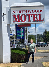
Lodging Secured
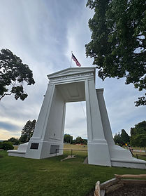
Scoping Out The Start-Line
_resized.jpg)
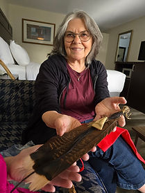
Magnificent Unexpected Gift For The Ride From
Judy WindSong Pryse
Haiku of the Day
Magnificent Gift
From Wise Spirits Heart & Soul
Golden Grace Received
Blaine stands within the ancestral homelands of Coast Salish peoples, particularly the Lummi Nation and the Nooksack Indian Tribe. The coastal waters, tidal flats, rivers, and forests of the region supported sophisticated communities whose lives were closely connected to salmon, shellfish, cedar, and the waterways of the Salish Sea.
The Lummi, or Lhaq'temish—“People of the Sea”—are especially associated with the coastal lands and waters around present-day Whatcom County and the San Juan Islands. Reef-net fishing, an ingenious and highly specialized salmon-harvesting method, is a particularly important part of Lummi cultural history.
For the Blaine to Maine rider: The ride begins not simply at an international border, but in a landscape shaped for thousands of years by Coast Salish peoples and by an ancient network of waterways, trade, family relationships, and seasonal movement.
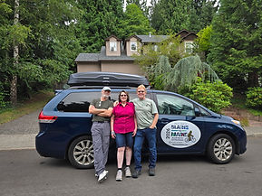
After wrapping up packing and tetris loading the van, the Team said goodbye to our daughter Sigrid and her partner Alee, excellent house sitters, their pup Clue and our pup Maya.
The kick-off event night before last brought Steve Jones into the picture. Lifelong friend and closest thing to a brother. Steve will be joining the ride from Blaine to Glacier Park, from Whitehorse, he will take the train back to Vancouver and drive home to Northern California. He is a welcomed team member.
Hard to fathom this moment following nearly 2 years of planning routes, lodging and countless other details required for a successful Coast to Coast Cycling journey, but it is here, now.
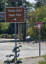
Dinner was Indian food just next door. Following dinner, Steve and I walked three blocks to Peace Arch Park to scope out the starting point, Identified the photos required for tomorrow and contemplated making a run for the border that now has a retractable temporary fence like you would find at the airport TSA line. Border Patrol kept a keen eye on our movements and we did consider putting our foot under the line and into Canadian Territory, but we will save that for tomorrow when we look less suspicious.
It's a beautiful park and this evening there were only a few other people there. Much different than the last time we were here in 2021 for Border to Bay. Our start date coincided with a running event the Ragnar Run. There were hundreds of people there at that time. We chatted a bit and some of them said, "why would you ride a bike from here to San Francisco?" and we asked them "why would you do a 24hour run to Whidbey Island?" Neither of us had a good answer.
We are set for ceremonial coffee at 0545 for a 06:30 start at the Peach Arch! Weather is good and spirits are high!
Day 1 Blaine to Concrete, WA
Indigenous Homeland:
Concrete lies in the upper Skagit River watershed, within the ancestral homelands of the Upper Skagit people and other Coast Salish communities connected to the Skagit River.
The river was—and remains—far more than a geographic feature. Salmon runs supported communities, trade, ceremony, and an extensive seasonal cycle. Villages and gathering areas were connected by the river long before roads or railroads entered the valley.
The modern Upper Skagit Indian Tribe is one of the federally recognized tribal nations whose ancestors lived throughout the upper Skagit watershed.
Off to a grand start! A few technology delays, but we arrived at the The Cascade Mountain Lodge in Concrete. A Lakota Elder, once told me, with every challenging activity, there will be Rattlesnake Tests to determine your resolve. We had several minor ones, but we overcame. More on Rattlesnake Test later. They can be big or small but always testing your resolve.
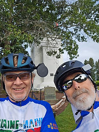
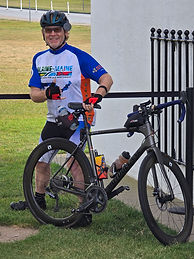
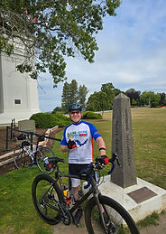
The day began with coffee! Then we moved to Peace Arch Park for a blessing by Elders Judy WindSong Pryse and Diane. Steve and I snuck through the gate prior to park opening and made our way to the Peace Arch for "Official Ride Start" and photos.
Terry broke the law and put his foot onto Canadian soil, fully expecting the Border Patrol parked close by to intervene. I think they were used to the actions of rebels and they did not pursue us.
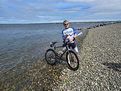
Rode into Bellingham for more coffee and a snack at the famous Woods Coffee where we performed the mandatory ritual of dipping our rear tires into the Pacific Ocean. This is a customary requirement for anyone cycling coast to coast. We were all pleased with the number of people who approached us and asked about the ride!
After the tire dunk, we ascended Chuckanut Hills where we gained most of our elevation for the day. The beautiful views of Bellingham Bay, Whidbey Island and the Olympic Peninsula. We met up with our support team at the Dogfish Point viewpoint for water food and hugs. While catching our breath, a group of riders pulled in and were asking about our ride. They had lost loved ones to ALS so they donated on the spot. We had a lengthy conversation about cycling. They also started at the Peace Arch, but were headed to Seattle to ride the STP-Seattle to Portland. Because I have ridden the STP 15 times, they asked about what to expect and I was happy to assist.
Once out of the Chuckanut Hills, we hit agricultural lands. We headed east from there and soon we were approaching the Sedro Woolley Valley. Surprisingly flat roads, but passing mountains that increased in size. At mile 70 we passed a herd of Elk. At 74 Miles, the view changed to a shiny flowing emerald. The Skagit River. At Mile 76 we arrived at our home for the night.
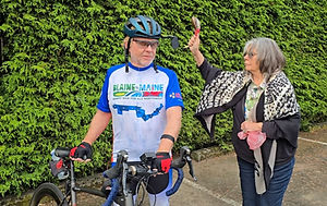
Blessing upon us!
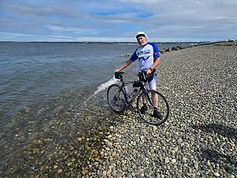
Living Dangerously
One Foot in Canada
Haiku of the day
Seamed concrete roadways
Rattles the cells in my brain
Craving Smooth Pavement
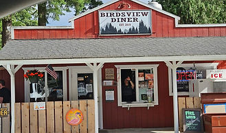
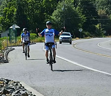
Ride Day 1 Complete!
Day 2 Concrete, WA to Colonial Creek Campgound
Indigenous Homeland:
Concrete lies in the upper Skagit River watershed, within the ancestral homelands of the Upper Skagit people and other Coast Salish communities connected to the Skagit River.
The river was—and remains—far more than a geographic feature. Salmon runs supported communities, trade, ceremony, and an extensive seasonal cycle. Villages and gathering areas were connected by the river long before roads or railroads entered the valley.
The modern Upper Skagit Indian Tribe is one of the federally recognized tribal nations whose ancestors lived throughout the upper Skagit watershed.
Late start and chain problems on Bear, Toland's Bike
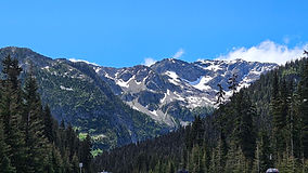
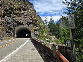
Entered the Cascades
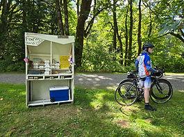
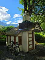
Stopped at a "tiny church" and a self serve food, fruit, eggs, bread, cold drinks, wooden puzzles and jewelry stand. Jones bought us an apples and Gatorade because he had the cash.
The climbing began in earnest today. I was surprised by Jones' fitness and stamina. Since we have not cycled together for decades, I didn’t know what to expect. Neither did he. I am pacing myself for the long haul. He is here for two weeks so his attitude is a bit different. He just needs to survive two weeks! That being said, we have ended up in a pretty good rhythm. I am happy to stop when he needs as I am conserving energy. Ride started on the cool side and ended hot. Traffic was okay in the morning but by noon, it was madness. Long strings of cars, mobile homes, trailers of all sizes and boats galore. Met a gentleman from Alaska sitting by the Skagit river reading a book, but was happy to talk. He had driven down through the Yukon. Lives in Talkeetna and was smart, and invested in raw acreage in Talkeetna. He works in construction and was telling us how construction continues in winter. They groom the snow for scaffolding and break ice when it forms. Shared a card with him. His journey will continue to Colorado, Tennessee, Zion National Park…lots of time and energy to explore.
We continued on and ground slowly up some hills as steep as 13%.
Diane met us for water replenishment at the entrance to the Cascades and then again 10 miles from the campsite for a turkey and provolone sandwich. Yum.
Confidence in tomorrows 5,000+ ft climb is opaque. We both have the goal of a successful climb, but it is very daunting.
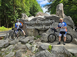
Day 3 Colonial Creek to Winthrup
Indigenous Homeland:
The Methow Valley is the ancestral homeland of the Methow people, an Interior Salish people closely connected to the river and valley that still carry their name.
The Methow lived along the Methow River and its tributaries, fishing for salmon, hunting, gathering roots and berries, and moving seasonally through the surrounding mountains.
During the nineteenth century, the Methow and neighboring peoples faced enormous pressure as settlers and miners entered the region. Federal policies and treaty-era actions ultimately forced many Methow people from portions of their homeland. Methow descendants are today represented among the Confederated Tribes of the Colville Reservation.
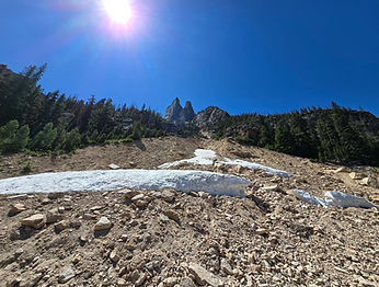
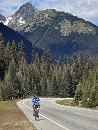
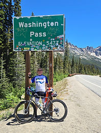
Another day of grinding our way uphill for 10 miles with some steep grades. Then 6 glorious downhill miles. Short mileage at only 47 miles, however it was loaded with 3200 feet of climbing. Not bad except this is the third consecutive day of climbs. Who planned this??
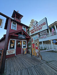
In Winthrup we stayed at The Virginian. A seasoned series of building that seem like they were all additions as time passed. Interlocking log structures made it interesting.
Four others in our building were on Harley Davidsons. Riding down from Canada, they have a large loop to cover. They were complaining about being tired from driving up the Cascades, I asked if they wanted to trade. No takers on that one. The newest Harley was this years model and the guys lifelong dream. $80k on two wheels.
Sherpa-Di has been working her tail off keeping Jones and I in water, food and whatever else comes up. On the long hills, she will drive ~5 miles ahead, find a safe spot to pull over and wait. She does have a book and loves to read. By the time we arrive, in just under an hour, we have at least one empty water bottle. A snack, drink and we’re off chasing elevation.
If I have not made it clear to this point I will now. This particular ride would not be happening without the all-encompassing duties of Diane. We owe her big time.
Day 4 Winthrup to Omak
Indigenous Homeland:
Okanogan lies in the ancestral homeland of the Okanogan or Okanagan people, part of the Interior Salish cultural and linguistic world.
Their traditional territory extends across what is now the United States–Canada border. That international boundary is a relatively recent political line across a homeland where families, trade routes, fishing places, and seasonal movements existed for generations.
The Okanogan River was an important travel corridor connecting the Columbia River with the interior plateau and lands farther north. Salmon, roots, berries, game, and extensive trade networks supported communities throughout the region.
Many Okanogan descendants are members of the Confederated Tribes of the Colville Reservation in Washington, while related Syilx Okanagan communities continue north of the international border in British Columbia.
Just prior to our departure, a woman approached us to ask about the ride. As it turns out, her father had passed from ALS at the age of 79 so she was very interested in supporting the cause. She was in Winthrup with 44 family members at a family reunion and and felt that our presence was a very interesting coincidence since the family patriarch was an avid athlete and would have approved of our adventurous mission.
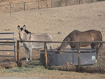
Wildlife spotted today included a zebra, some marmmants, chipmonks, deer and a couple different kind of snake.
Another day of grinding our way uphill for 10 miles with some steep grades. Then 6 glorious downhill miles. Short mileage at only 47 miles, however it was loaded with 3200 feet of climbing. Not bad except this is the third consecutive day of climbs. Who planned this??
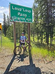
Today we skirted the B & O fire just to our North and made it into Omak. From forests and waterfalls to desert. The temperature rose from a pleasant 52 F to 90 F. Tomorrows ride will be yet another elevation challenge. 65 miles and 4800 feet of climbing. Onward!
Haiku of the day
Glorious Mountains
Clear snowmelt cascades in veils
Beauty, flow duel
Day 5 Omak to Republic
Indigenous Homeland:
The Republic area lies within the ancestral homelands of Interior Salish peoples, particularly the Sanpoil and neighboring peoples whose lives were connected to the Columbia River Plateau.
The Sanpoil lived along the Sanpoil River and surrounding lands. Fishing—particularly salmon fishing—was central to life, supplemented by hunting and the gathering of roots and berries.
Today, Sanpoil descendants are represented within the Confederated Tribes of the Colville Reservation. The Confederated Tribes are not one historical tribe but a confederation of 12 distinct tribes, each with its own history and ancestral lands.
The arrival of miners during the late nineteenth-century gold rush dramatically transformed the Republic area and intensified pressure on Indigenous lands.
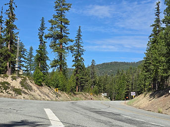
Todays ride featured a bit of wildlife and Wauconda Pass. We thought we had left most of the big climbing behind us and then we ran into Wauconda! This day was a hot one. We started too late and were baking in the sun for most of the day. Not so many trees so we felt particularly exposed. First real mechanical problem with my bike "Bear." I had a tire blow out in the scorching sun so we stopped to fix it. When it happened I immediately knew the cause. When I pulled the tube out, I found that the rim tape had migrated leaving some of the holes where the spokes attach to the rim exposed. Because these rims are 80mm deep, the whole is about 1/2 inch in depth. Without the rim tape to block the hole, the tube expanded into the hole and burst.
Digging out my spare tube revealed bad planning on my part. The spare tube had been in my underseat pouch for a couple of years and when I tried to inflate it, I found the rubber had been damaged near the valve stem and could not be repaired. Diane and I had invested in the emergency GPS device that allows for texting via satellite, so I figured this was a good time to try it. I remember the instructions said depending on location and satellite position it could take a while to transmit the message. There was no cell phone out here. So I sent my message "Flat tire, please come back" and waited. In the mean time, we decided that Steve should continue on and I would catch up to him.
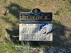
While replacing the tube, a large pick-up truck had pulled into a gate across the highway. He opened the gate and disappeared up the hill and into the rocks. As I stood there looking stupid in the sun by myself, he returned back down to the gate. He hollered across the road "Do you need a ride somewhere?" As he pulled across the road and stopped I explained that my ride support was up ahead 5 miles. He said "Well, I can take up the road a piece or all the way to Spokane where I'm headed." Having not heard back from Diane, I said "lets see if we can meet up with my wife" So I put the bike in the back of his truck and climbed into air conditioning that felt like stepping into a freezer and we headed up hill. He was up on the hill surveying for a new cell tower. He said "you might have noticed there's no cell phone service here!" We talked about his work that included communications work for BPA and other Utilities. In just a few minutes, the support van was in sight and he pulled over. Rather than working any more on bike, I pulled my spare bike out and put the problem bike in the van. As I was doing so, we all heard the satellite alert message come in on Dianes device. 32 minutes it took to arrive. A good practicle test. As soon as Steve caught up, we continued onward and arrived in Republic.
Haiku of the day
Sherpa-Di
Distant conifers
Early morning sounds of geese
Placid mountain lake
Day 6 Republic to Colville
Indigenous Homeland:
The Colville region is associated with several Indigenous peoples of the Columbia Plateau and Interior Salish world, including the Sinixt, Lakes, and neighboring peoples now represented within or historically connected to communities on both sides of the U.S.–Canada border.
The name “Colville” can create confusion. The Confederated Tribes of the Colville Reservation are a political confederation of 12 tribes rather than a single people historically called simply “the Colville tribe.”
Those constituent tribes are the Arrow Lakes, Chelan, Colville, Entiat, Lakes, Methow, Moses-Columbia, Nespelem, Okanogan, Palus, Sanpoil, and Wenatchi peoples.
The broader region was part of an extensive network of fishing locations, gathering grounds, trails, and trade routes centered on the Columbia River system.
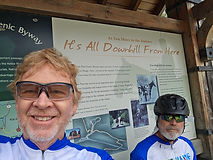
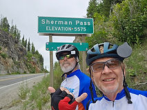
Today presented the last of the gargantuan summits, Sherman Pass. We decided to start early, but not early enough to miss the heat and it caught us good. The high was 97F which is not a problem until we reached the uphill portion. We had 3 miles of flat before the approach to Sherman Pass. It was a challenge. At 5505 feet, the air is thin as I have mentioned before. Having trained at sea level for the most part, we both found ourselves breathing harder than usual. We had to slow down and trudged up the hill between 5-6 mph, but we made it. Then came the grand downhill.
Downhill is the reason for riding uphill. Nothing like steep riding two wheels on swooping curves at 40 mph for 10 miles.
Sharing the road with large trucks was the game of the day. The Department of Agriculture were spraying the sides of the highway with weed killer, I am sure bad for our lungs. It made me cough. Large water trucks headed no doubt to suppress fires somewhere and of course the iconic logging truck. Loaded logging trucks up the pass and empty logging trucks coming down the pass. All travelled very fast. They create a pressure wave as they begin to pass and then a suction behind them as they formalize they dominance on the road. Both the push and pull make for a bit of instability on the bikes.
Diane met us every 5 miles going up the pass to reload our water bottles and feed us. On the down hill side, she met us again at the bottom of the hill with lunch at a nice historic rest stop where there was once a dam across Sherman Creek. The flying bugs were hatching in the shade of the forest and the two riders acted as fly paper as we sped down hill. Sunscreen was the glue and captured thousands of unknown flying things. We were able to wash them all off prior to eating lunch.
We arrived in thel town of Colville in the late afternoon, hot, hungry and tired.
_resized.jpg)